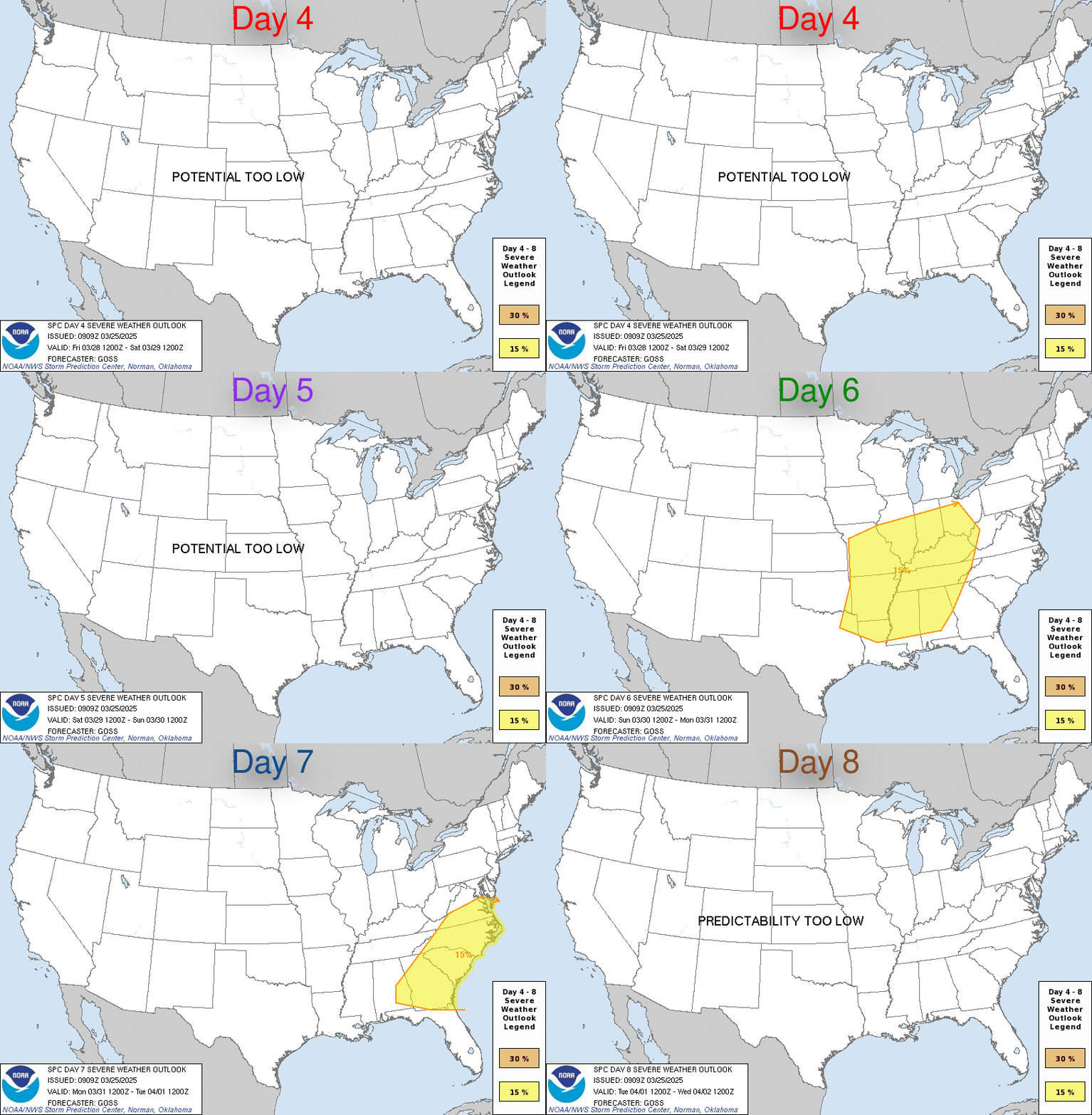
Day 4-8 Severe Thunderstorm Outlook
| Day 4-8 Severe Weather Outlook. A depicted severe weather area indicates a 30% or higher probability for severe thunderstorms within 25 miles of a point. |
| D4 | Tue, Apr 23, 2024 - Wed, Apr 24, 2024 |
D7 | Fri, Apr 26, 2024 - Sat, Apr 27, 2024 |
| D5 | Wed, Apr 24, 2024 - Thu, Apr 25, 2024 |
D8 | Sat, Apr 27, 2024 - Sun, Apr 28, 2024 |
| D6 | Thu, Apr 25, 2024 - Fri, Apr 26, 2024 |
(All days are valid from 12 UTC - 12 UTC) |
PREDICTABILITY TOO LOW is used to indicate severe storms may be possible based on some model scenarios. However, the location or occurrence of severe storms are in doubt due to:
- 1) large differences in the deterministic model solutions,
- 2) large spread in the ensemble guidance, and/or
- 3) minimal run-to-run continuity.
|
| POTENTIAL TOO LOW means the threat for a regional area of
organized severe storms appears highly unlikely during the entire
period (e.g. less than a 30% probability for a regional severe
storm area across the CONUS through the entire Day 4-8 period). |
Images courtesy of the NWS Storm Prediction Center
Warning:  file_get_contents(http://w1.weather.gov/data/WNS/SWOD48): failed to open stream: HTTP request failed! HTTP/1.0 403 Forbidden
 in /home/metzeric/public_html/wxspc48.php on line 158


 Home
Home Live Radar
 Live Lockport Sky
 Live Console
 Live Gauges
 Live Scanner Niagara County
 Live Deer Cam
 7 Day Forecast & NWS Charts
 LIVE WNY Weather Conditions
  Almanac
 Station Historical Data & Records
 Marine Info
 Other WX Stations
 Webcams
 Real Time Lightning Map
 24 Hour Rainfall Forecast
 Niagara County Wind Alert
 WNY Satellite
 Niagara County News
 Real Time Weather Twitter
 World Wind Map
 Tornado Report
 Earthquakes
 Flight Tracker
 Closings/Delays
 WNY Snowstorm Total Forecast


